Listeners:
Top listeners:
-
 play_arrow
The Rock 106.7
-
play_arrow
K-Country 105.7
-
play_arrow
Q104.1 Central Kentucky's Hit Music



 John Patrick “Johnie” Pierce
 Pair Of Pulitzer Prize Recipients To Bookend 2026-27 Lindsey Wilson University Theatre Season
 Taylor County Grand Jury Indictments: August 2026
 Trooper Seth Stockton Joins KSP Post 15 After Academy Graduation
 Lindsey Wilson University Counseling Professor Honored For Work With Journal



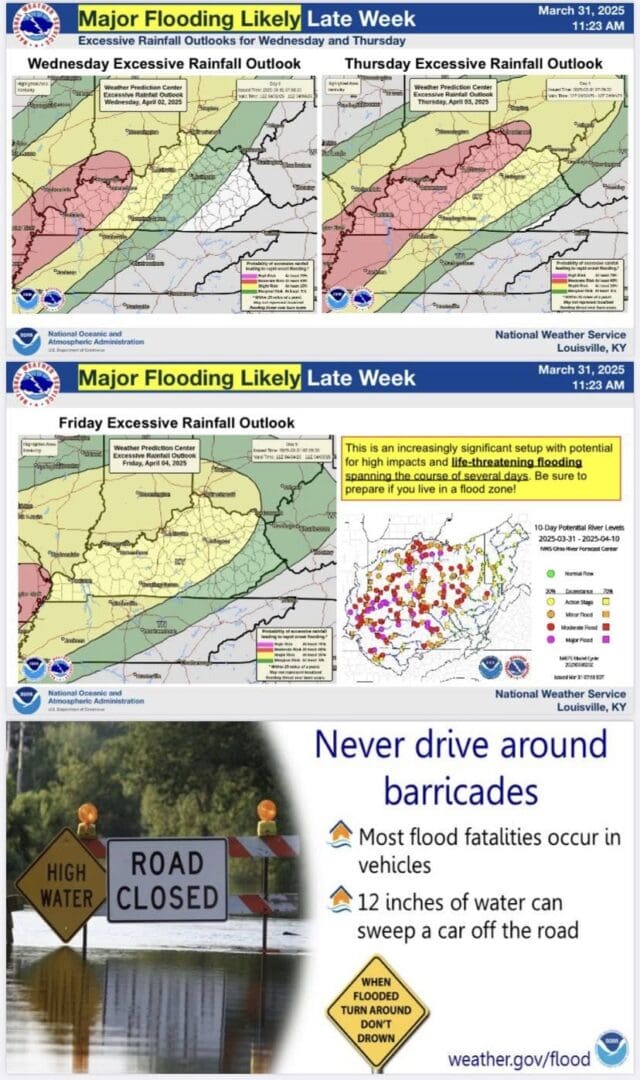
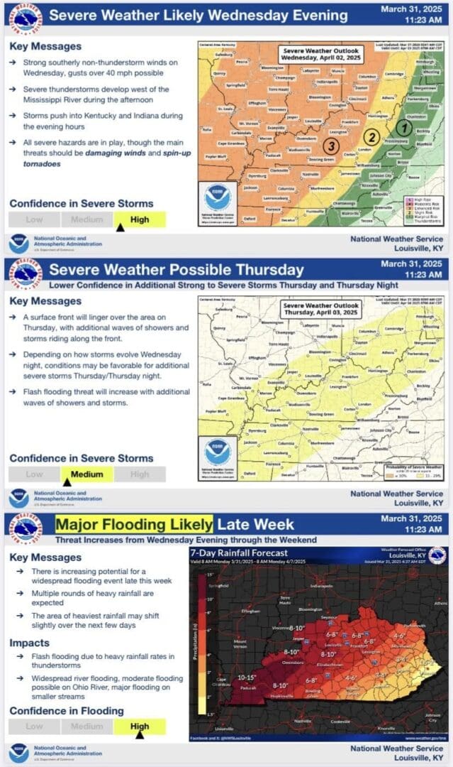
We’ve updated our briefing slides today, and have put a heavier emphasis on the potential for major flooding late this week through the weekend. Rainfall totals over the next seven days may accumulate 6-10 inches, especially over southern Indiana and the northwest half of central Kentucky including Louisville, Lexington, and Bowling Green. Significant, life-threatening impacts will occur if these rainfall totals are realized due to flash flooding with heavy thunderstorms as well as moderate to major river flooding. Significant flooding will be possible on all streams over the next 7-10 days, including the Ohio.
Please stay tuned as the forecasts are updated over the next several days. Small geographical changes in the corridor of heaviest rain can lead to large changes in impact at any one location.
(NWS Louisville)
Similar posts

Latest posts
John Patrick “Johnie” Pierce
Pair Of Pulitzer Prize Recipients To Bookend 2026-27 Lindsey Wilson University Theatre Season
Taylor County Grand Jury Indictments: August 2026
Trooper Seth Stockton Joins KSP Post 15 After Academy Graduation
Lindsey Wilson University Counseling Professor Honored For Work With Journal